Professional Work
|
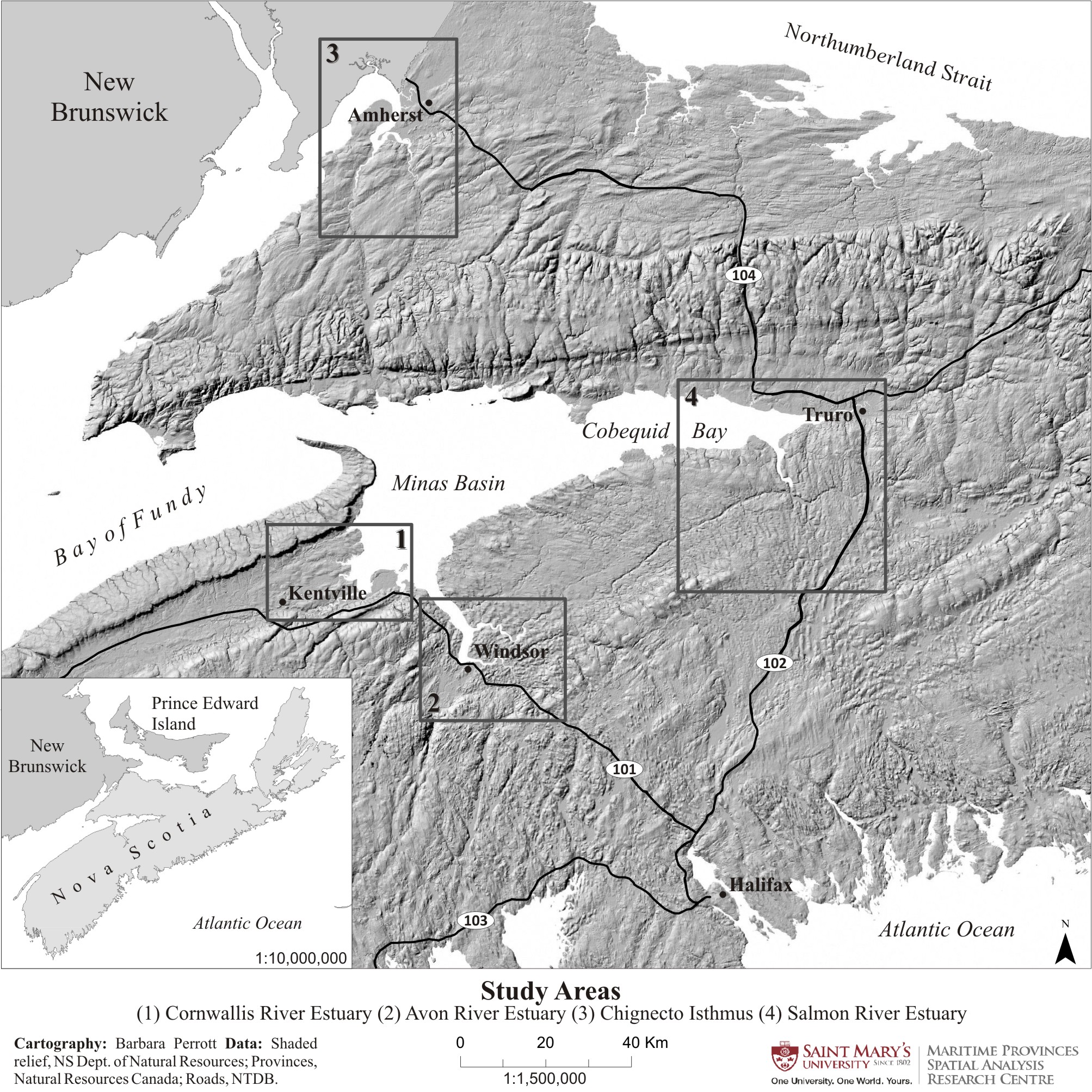
Journal of Coastal Research
Created in ArcMap 10.0, layout & design CorelDraw X4
I created these maps for the article published in the Journal of Coastal Research. The maps were created in grey-scale, requiring careful selection of various shades of grey as well as white and black, without losing the details of features. |
|
LaPlanche River Study AreaCreated in ArcMap 10.0
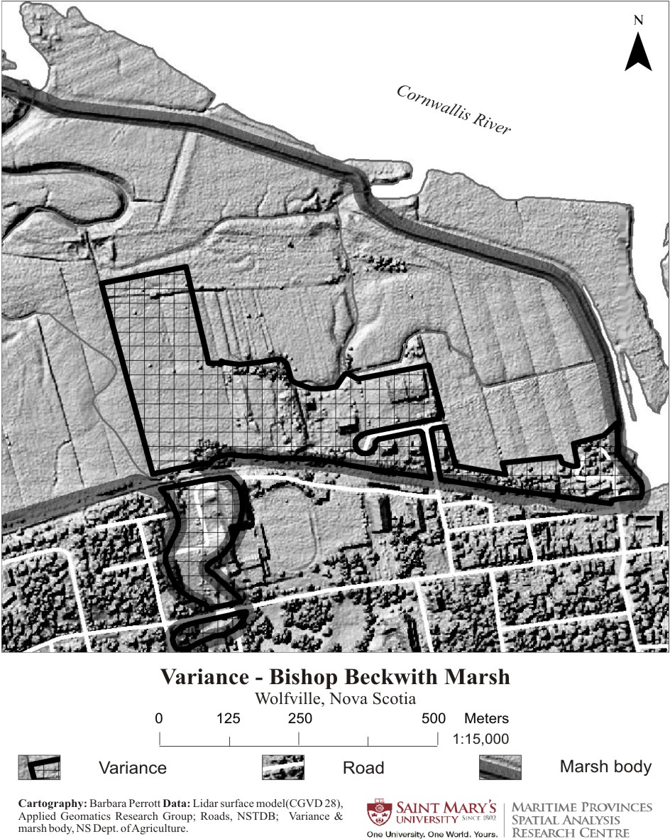
Created for a local engineering firm studying the replacement of an aboiteau. |
|
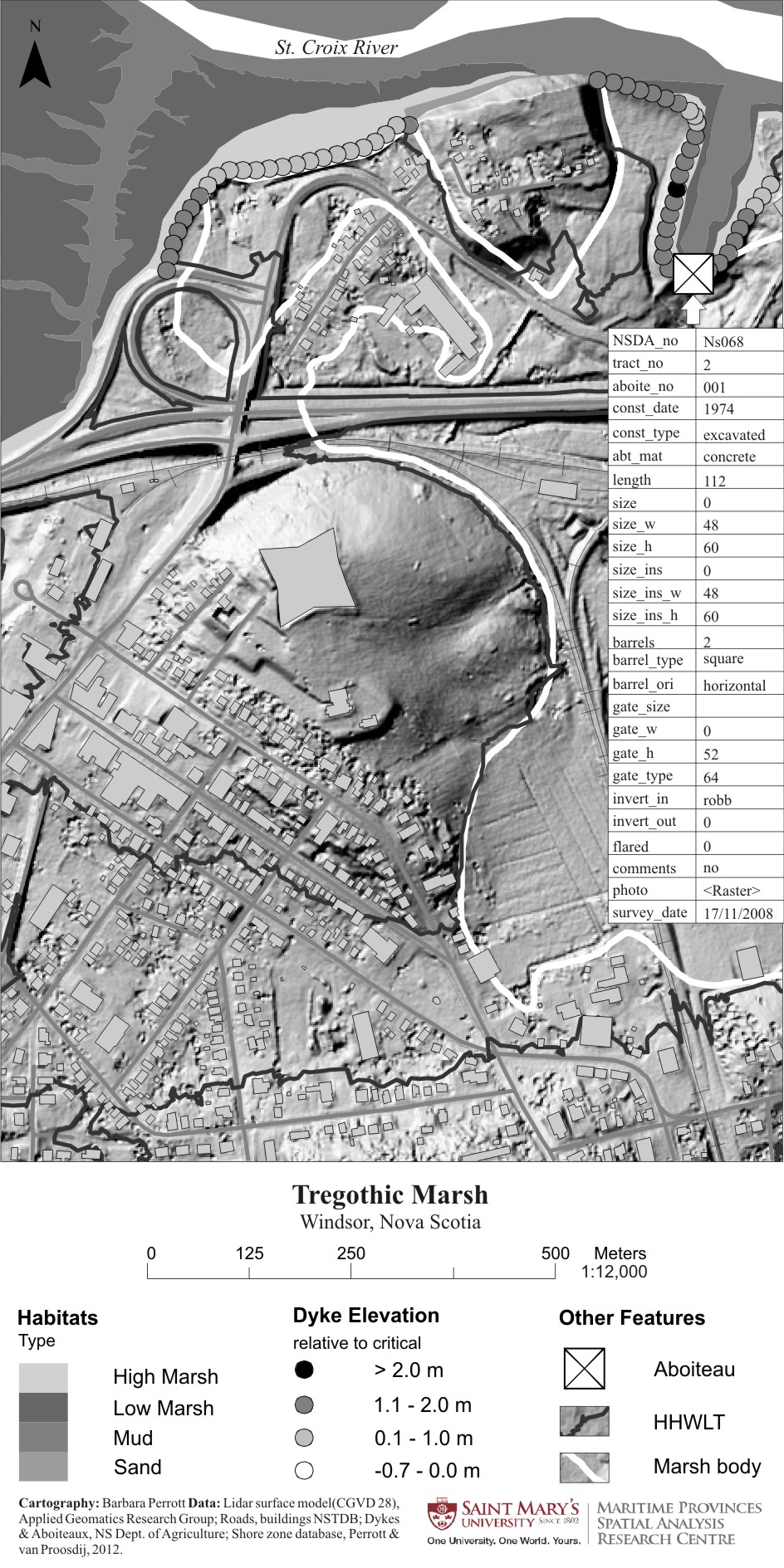
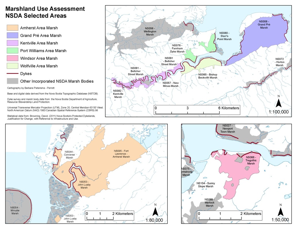
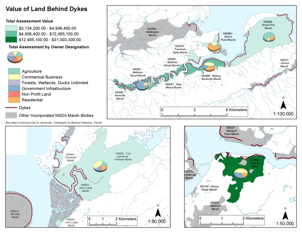
Atlantic Climate Adaptation Solutions Association (ACASA)
Created in ArcMap 10.0
These maps were created for an ACASA report written by Danika van Proosdij and Samantha Page. Numerical data (assessment values) were added to existing shapefiles to be able to represent the data in pie charts. |
|
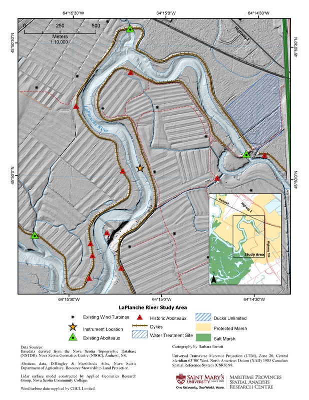
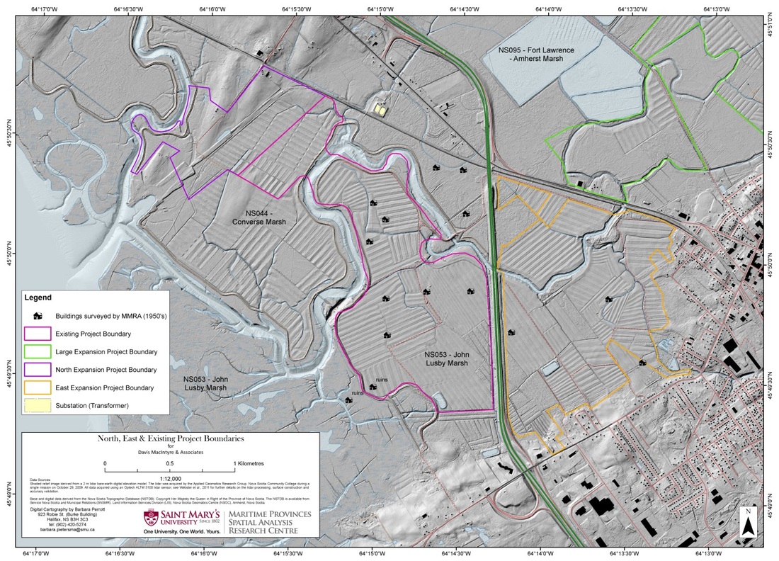
Archaeology
Created in ArcMap 10.0
A map created for local archaeologists looking for Acadian cellars (building foundations) near a site being excavated for wind turbines. Archaeologists used depressions found in LiDAR data to ground truth cellar locations. Locations of barns (or buildings in the map's legend) were digitized from geo-referenced marsh plans drawn in the 1950's. |
