GIS Analysis
|
3D Visualization using LiDARCreated with ArcMap 9.3.1, ArcScene, Command line and CorelDRAW X4.
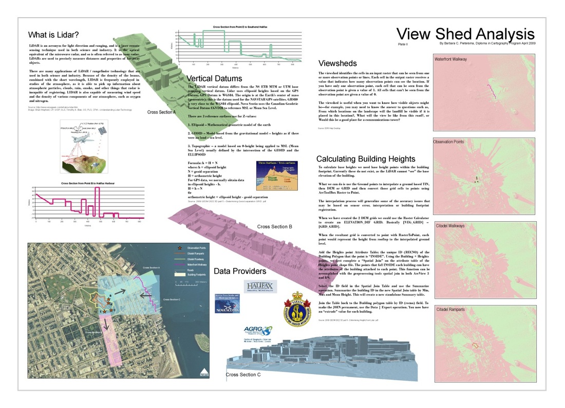
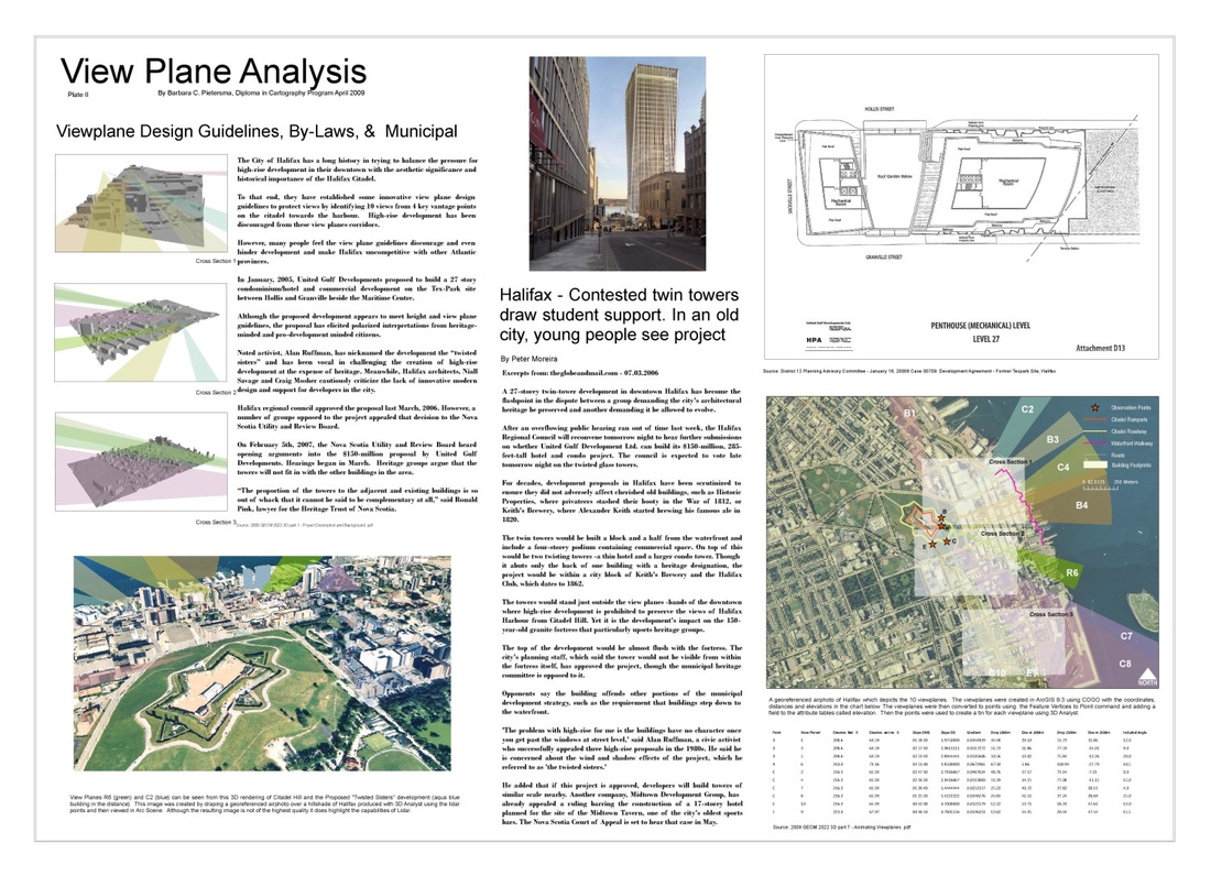
This project visualizes and assesses Downtown Halifax development and, in particular, its visual impact on the views from and of the Halifax Citadel. Also included is the United Gulf building proposal and an assessment of the building's impact regarding scale, form and compliance to Halifax's view plane guidelines. AGRG LiDAR was used to determine building heights and model the view plane geometry. |
|
Wind ModelingCreated with ArcMap 9.3.1
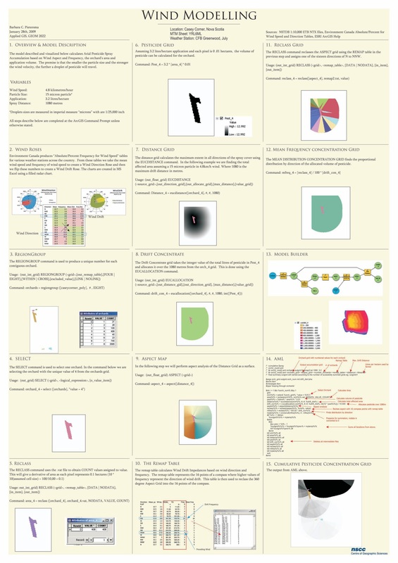
This project introduces Wind Dispersion, Atmospheric and Fire, Smoke and Pollutant Models and uses CostDistance and PathDistance functions to generate a "pressure" surface grid from a wind reference line. A wind direction surface is also created using the EucDistance function and the 3D Analyst Tool "Steepest Downhill Path" is used to examine wind vectors graphically. |
|
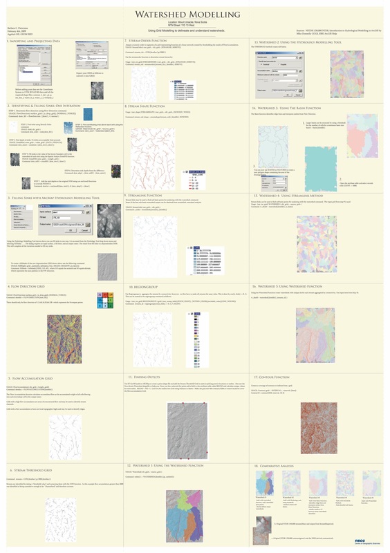
Watershed AnalysisCreated with ArcMap 9.3.1
|
|
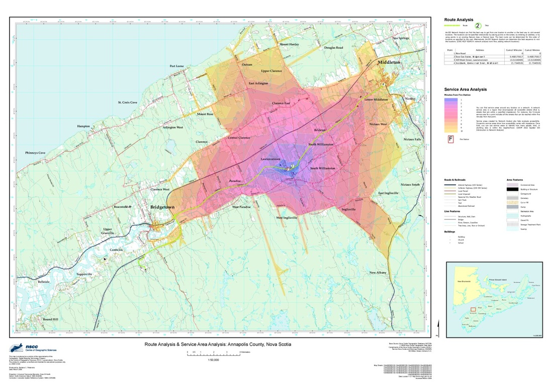
Route Analysis and Service Area AnalysisCreated with ArcMap 9.3.1
|
|
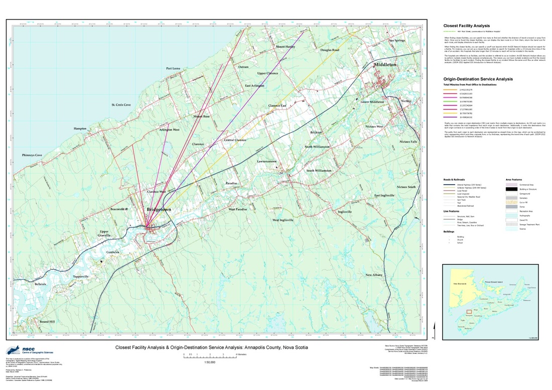
Closest Facility and Origin-Destination Service AnalysisCreated with ArcMap 9.3.1
|
