Thematic Maps
|
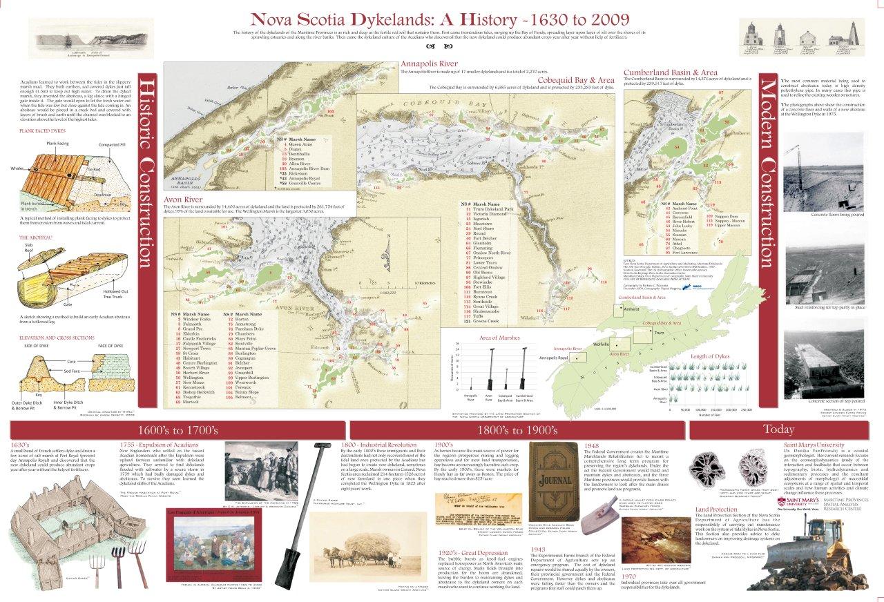
Nova Scotia Dykelands: A HistoryMaps created in ArcMap 9.3.1, layout & design in CorelDraw X4
A thematic map outlining the history of dykeland construction in Nova Scotia. The main purpose of the map: • Follow dykeland construction from the Acadians to present day; • Highlight how construction techniques have evolved; • Show where the dykes and marshland they protect are located; • Highlight importance of dykelands today and in the past (ie. Agriculture) Notes:This project took months of research through publications and online archives to source historic photographs and information. Historic nautical charts from the UK Hydrographic Office were also georeferenced and placed under current day data. I also collaborated with my husband Aaron Perrott who drew technical drawings of aboiteau and dyke construction for the project. |
|
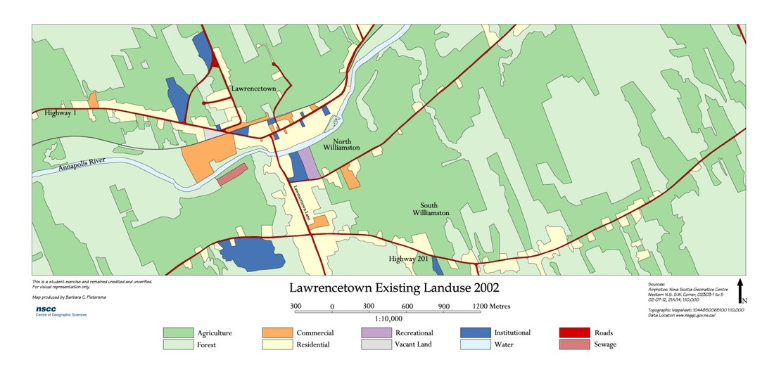
Lawrencetown Existing LanduseCreated in AutoCad Map 3D 2008
This started as five, 1:10,000 air photos, which were georeferenced and rubbersheeted to create a mosaic. Using the Semi-Controlled mosaic, I identified landuse for the area by creating a line drawing over the mosaic which I then used to create polygon topology using AutoCAD Map tools. I then attached object data to each polygon and symbolized each polygon. |
|
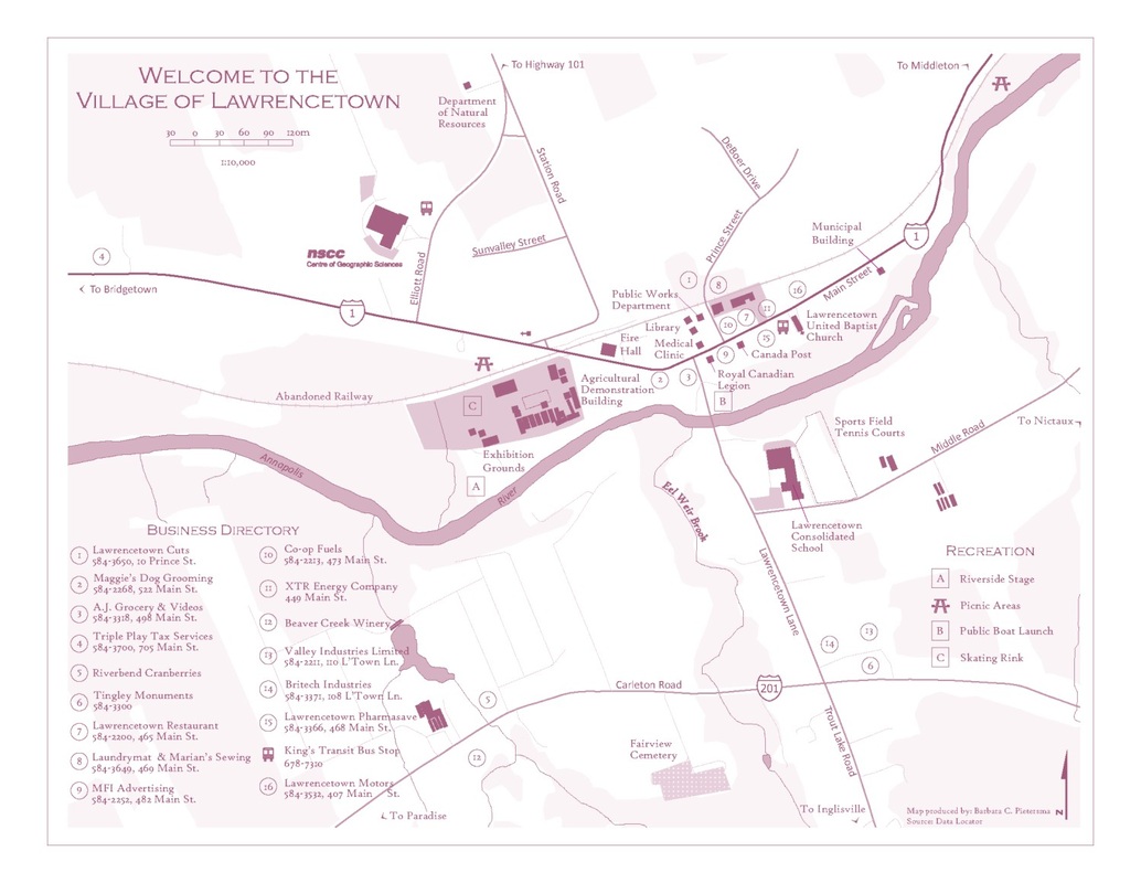
Village of LawrencetownCreated in CorelDraw X4
|
